I followed the process on David Rumsey’s Georeferencer to “fix the location” of a map. Initially, I attempted to fix a few other maps. The first one was an old map of some area of Prussia. I thought I had found the correct spot, but it did not fit well. Since I could not find enough similar points to justify a match, I decided to try some other maps. The next couple I got were in a different language and landlocked. This made it almost impossible to identify exactly where it was located.
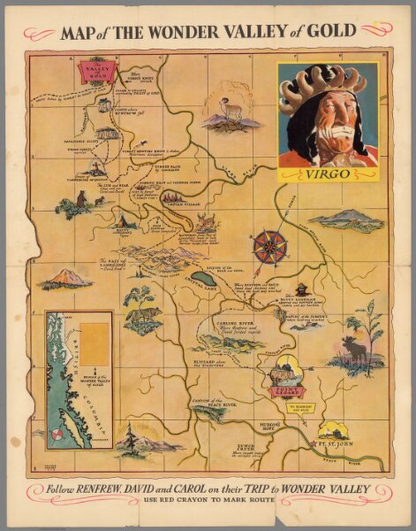
The one I finally settled on was fixing the “Map of the Wonder Valley of Gold” to the base map of the world. This one was relatively easy as the map indicated it was in British Columbia and gave a nice wide-view box, which made it easy to find the general area on the base map. I could then find enough similarities with the rivers (and river settlements such as Hudson’s Hope or Fort St. Johns) on both maps to connect the maps well enough.
The link to the rectified map is HERE.

Although it’s not perfect, it is close enough given the roughness of the overlayed map.
This process helped me understand how useful spatial DH can be in interpreting and cataloging historical maps or art. It looks like, if we wanted to, we could access the rectified map in a couple of GIS formats/software or GeoTIFF format. Once we have a geo-rectified map, we can create a project that either displays the culture of that area at the time, or how the area might have changed (or changed in depiction) since the map was created. The next steps would be further analysis of similar maps or artifacts in that region/time.
A problem a ran into with geo-rectifying was that many maps are simple such as this one. It does not match well since there is not much detail, and it does not overlay well. This method would not be appropriate for precise descriptions of the geographic differences over time, since it is not a precise enough process.