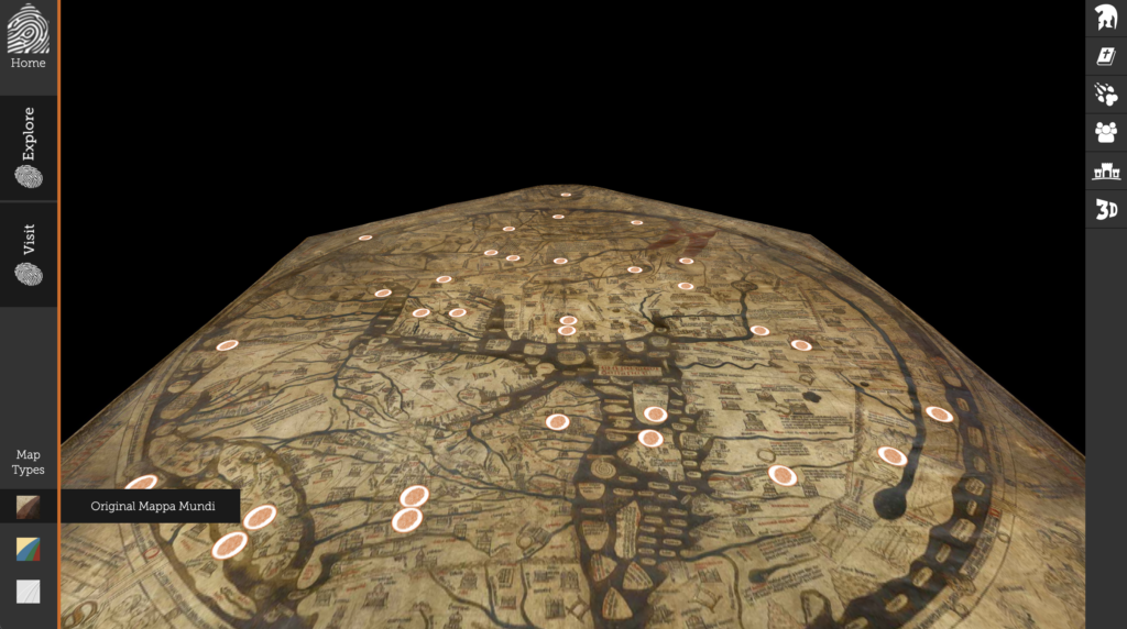
The digital humanities project that I analyzed is called The Mappa Mundi. It is a digital version of an ancient map called the Hereford Mappa Mundi, a mappa mundi being a type of medieval map and Hereford indicating the location of its discovery.
The most important source for this project is the Hereford Mappa Mundi itself, which is a stylized map approximately 1.5m x 1.3m showing important locations in Southern Europe and the Middle East. There is also information included about a number of the map’s features, but these short blurbs are not credited to any specific works or individuals.
The Hereford Mappa Mundi itself was processed in three ways for this project: first, there is a scan of the map in its current condition; second, there is a scan labeled “color enhanced”, in which the map’s features were made more clear, its colors were altered to be more distinct, and the map as a whole was made brighter; finally, there is the blank, grey 3D scan of the map without any of the imagery, smudges, or colors. Many of the illustrations on the map were interpreted and had this information attached to them, and they are broken into categories of cities, beasts, Greek/Roman legends, Bible stories, and peoples of the world.
The presentation is a model of the map with markers placed according to the category the user has selected. Upon clicking one of these markers, the “camera” zooms in on that location and a body of text is displayed on the side of the screen detailing what the item or landmark represents.
I don’t think the site makes an argument. It seems to be purely descriptive in nature, and the amount of buttons on the site with which one can schedule a visit to see the map give the impression that this project is meant to be a gateway into this historical site rather than a total encapsulation of what it has to offer.
A question I had while thinking about how this project was made is about how to safely 3D model ancient and fragile artifacts. It seems like the best way to put a project like this together would be to scan it using a specialized piece of equipment, but that often requires moving the item in question. Are there special tools used specifically for artifact scanning that don’t require as much handling of the subject?
1 thought on “Reflective Blog Post #2”
Comments are closed.
I really liked your analysis, it is very detailed and you captured all the processes involved in scanning the Mappa Mundi and publishing it online. Do you think if they were to scan different objects/texts they would use the same techniques/processes?
Still, I disagree that the site is a gateway for people to visit the historical site. I believe it can be used by students and scholars who want to study the device.