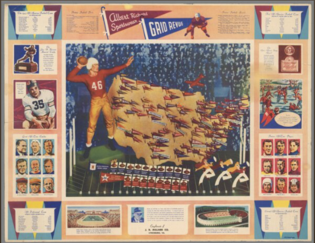
This week we looked at the David Rumsey Map Collection and learned to rectify the physical maps from the 16th through 21st century in the collection to the digital space. This required matching points on both maps to line them up. The map I worked with was a college football map of the US. There were a few details in this map that made the process slightly harder than I had expected. For starters, the map was slightly slanted so matching the coordinates to the map was difficult and since the entire poster had more than just the US map, it was all crooked when lined up. More so, the country itself is slightly distorted in the map because the football player and other decorations are covering part of the country by the coasts as well as the outline by the Great Lakes is not completely accurate.

Despite some of these troubles with georeferencing and maps not lining up, the tool is still very fascinating. I really enjoyed the process of rectifying and the different options like overlay or lens that let you see the transition from the map to the coordinates is quite interesting. Once the map is rectified there are also many more opportunities because Rumsey’s site offers different links like Web Map Tile Service (WMTS), TileJSON, and XYZ to use on other GIS platforms. An option to use this tool could be layering with other maps to see how different data overlaps or correlates. For example, if there is a map of top colleges in the US that is overlapped with this map, we could see the relationship of how the prestige of the colleges relates to their sports teams in the US. With that being said, I think it is also important to recognize that not all questions can be answered with georeferencing especially when they looking at questions with not relevant to locations. However, when looking at spatial data, the possibilities with georeferencing seem endless.
2 thoughts on “Spatial Mapping and Georeferencing”
Comments are closed.
I also had an issue with the maps not aligning perfectly. I think it is interesting how GIS can be used to layer maps one may not have thought of, such as a college football map of the US. However, challenges do arise when the map was created for the purpose of illustration rather than accuracy. While georeferencing can cover an extensive range of questions, there are definitely limitations.
I also had problems with aligning, but I realized that there are different ways of aligning in ArcGIS (there is a polygon option. It is also possible to cut out the margins, and those options are very helpful to me. I agree with your point that overlaying maps on each other help us see correlation, creating many possibilities in the realm of DH.