The World Historical Gazetteer is a tool that makes historical research more accessible by making it easier to find the locations of historical events. Specifically, it serves as a database of the locations of cities, buildings, and other historical places that may no longer exist. This is useful for DH work because it allows users to better understand the locations of many historical areas, and could be useful for any sort of DH work related to mapping.
To better understand this tool, I will show it could be useful in the context of georectification, using the David Rumsey Historical Map Collection, a separate program that still provides a good demonstration of this tool’s capabilities. I will also explain how it allows you to begin the process of enhancing your own understanding of historical locations using the information included in the datasets WGH is based around, providing a springboard for further exploration for non-experts.
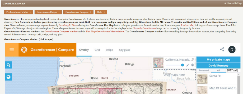
- Open a new map using the “fix location of a map” section of the website. The best maps to use for this project are in English, and show settlements rather than individual buildings.
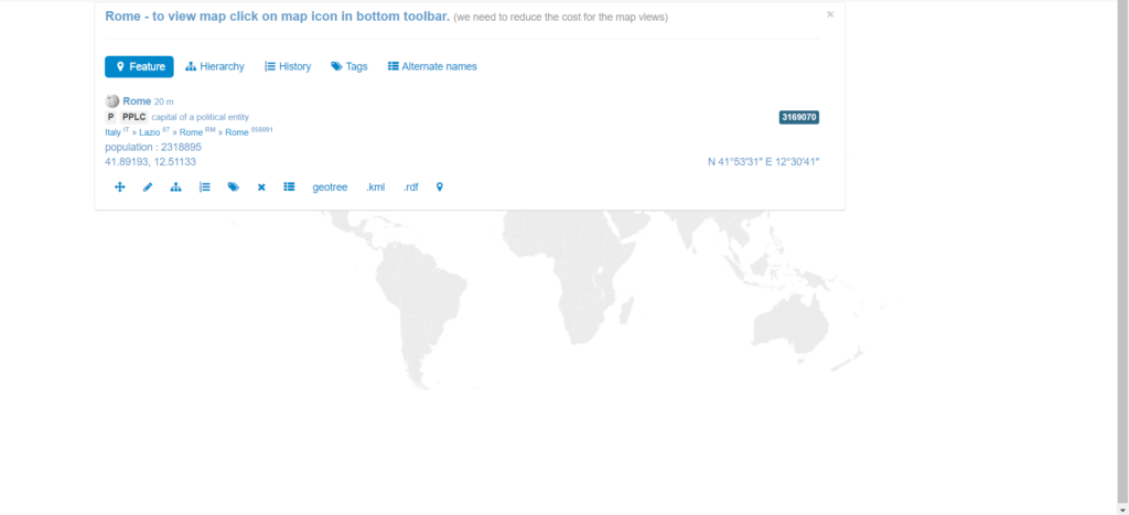
2. Search for a location from the map in the World Historical Gazetteer. Multiple locations may appear, cross reference with the map to make sure you’re picking the correct one.

3. Connect the new location in the map to the original. When doing this, make sure that you’re clicking precisely on the map, as even small inaccuracies can have a big impact on the accuracy of the final product.
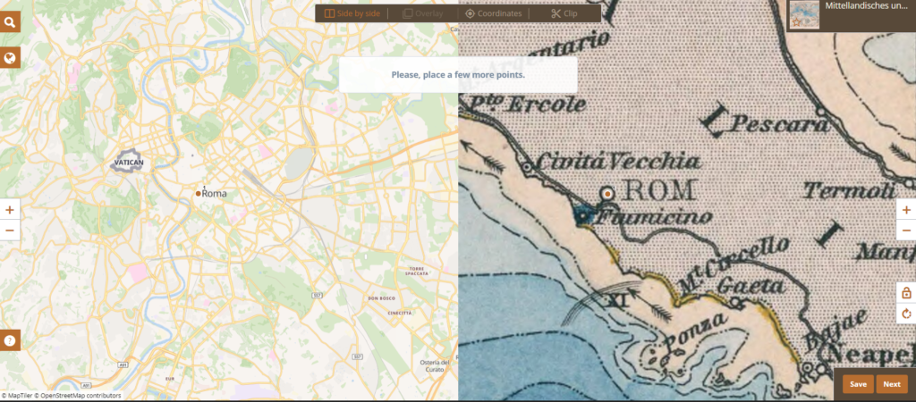
4. Repeat this process until the map is more geographically accurate. Doing this about ten times helps to make sure the map is working correctly, and creates a relationship between places in the real world and the historical map that is fairly strong

5. Use the data within the WHG to better understand the locations of the place you chose. Clicking the links beginning with gn: will lead you to Wikipedia, which is a good starting point for further research.